**
Pardon me as I rebuild the site.
Some project pages are currently unavailable.
**

Perfect View

2004 - 2005
perfect view

Project Description

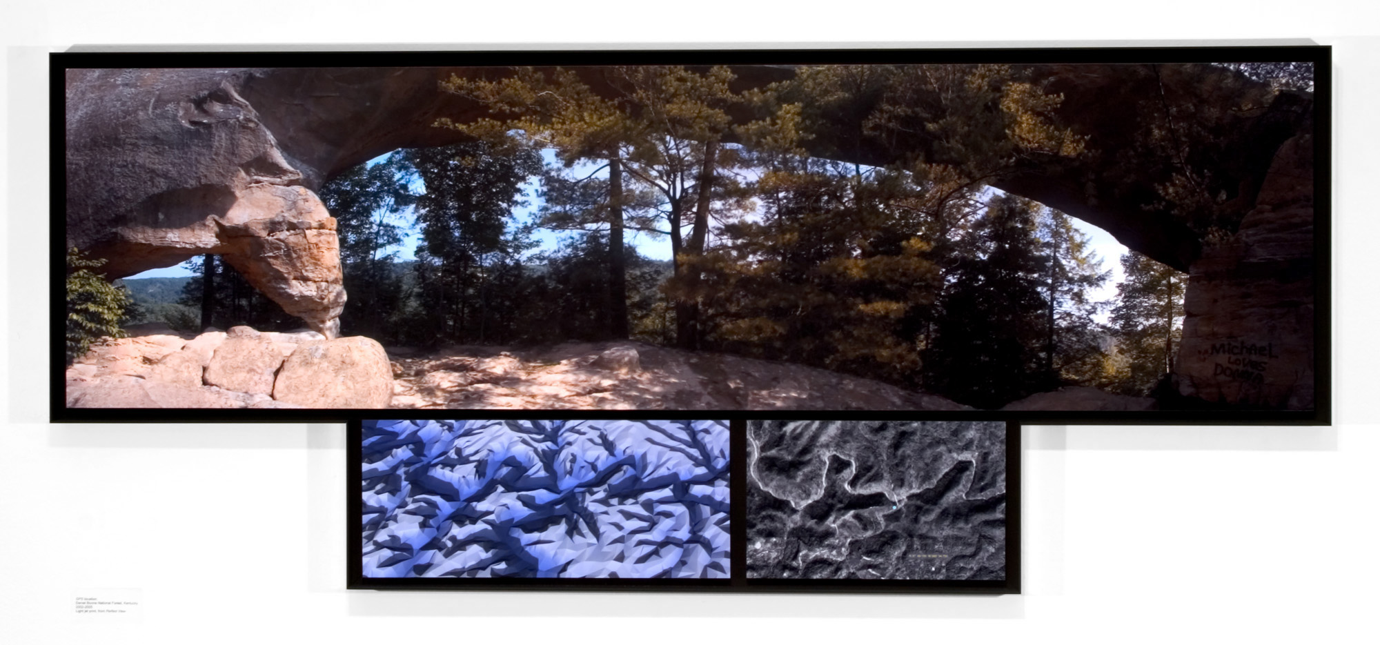
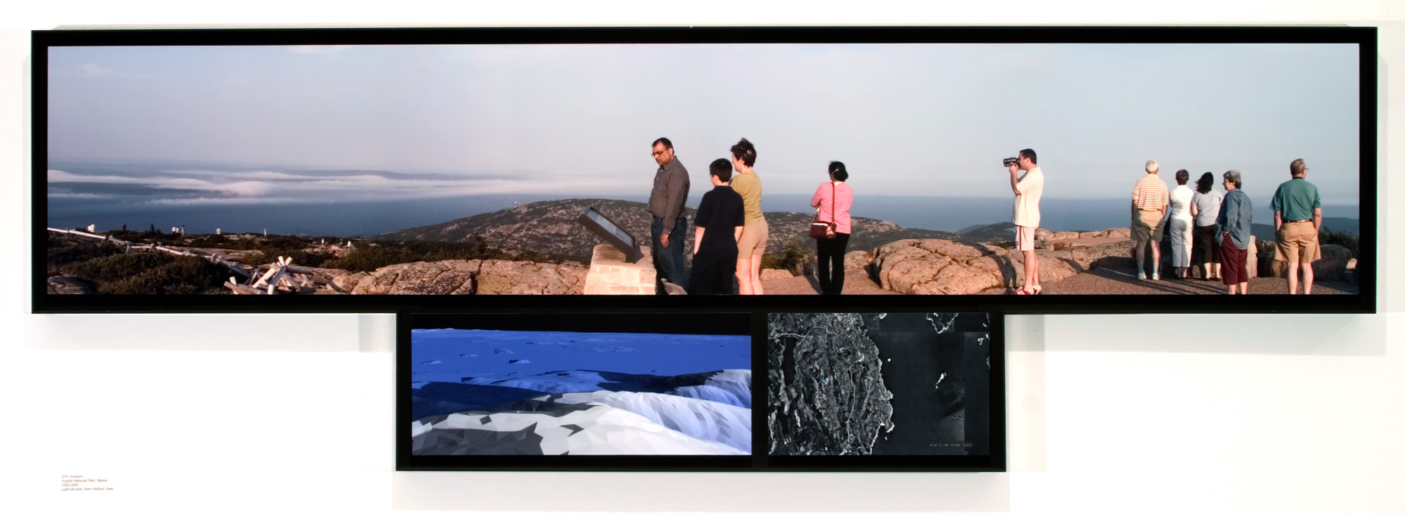
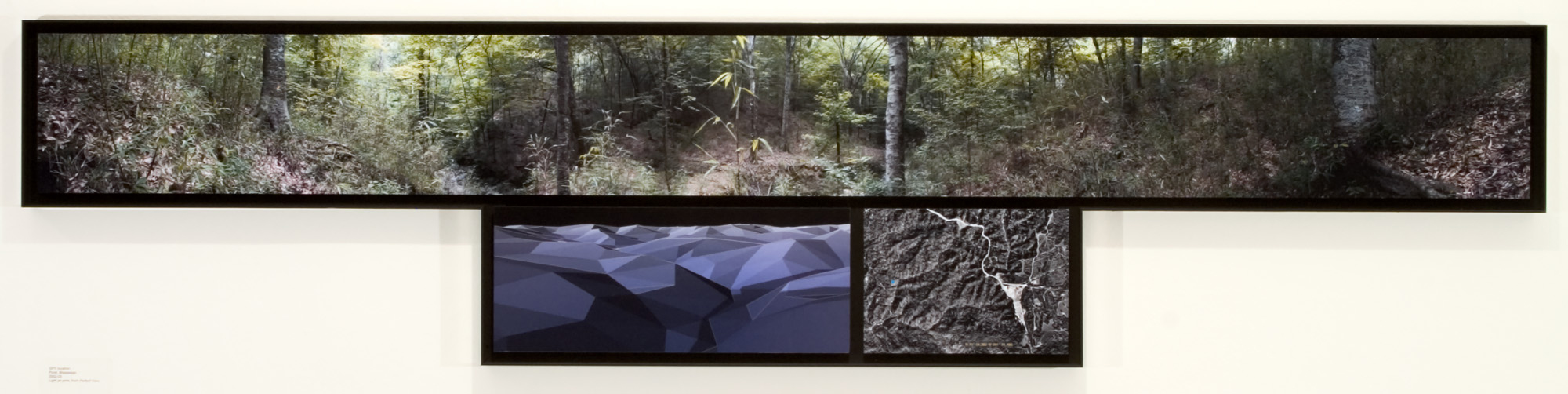
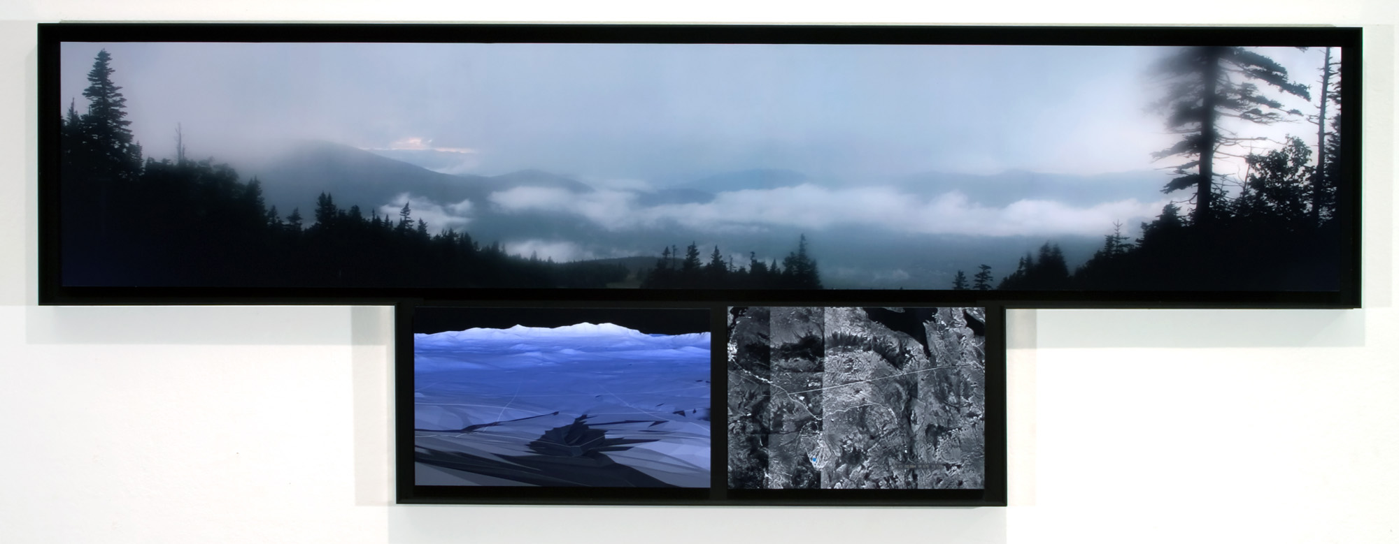
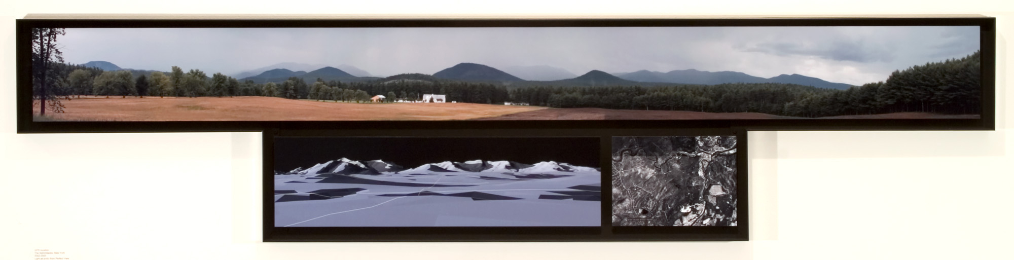
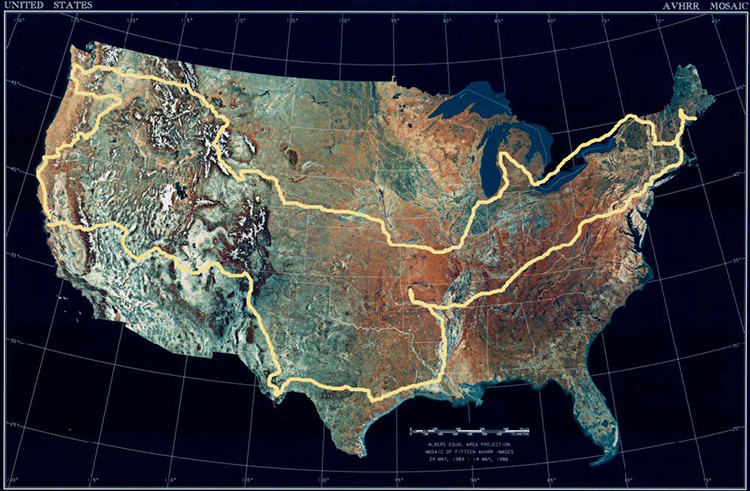
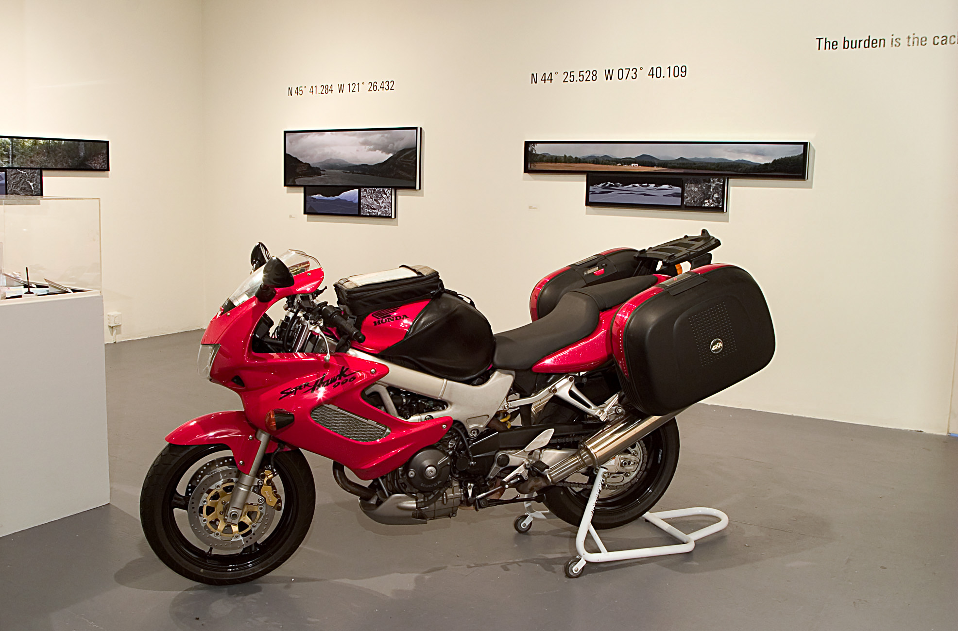
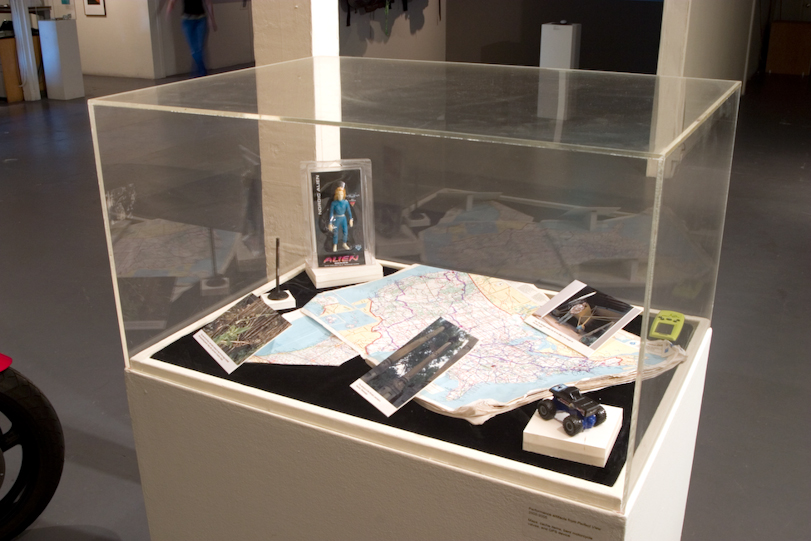
Perfect View is an exploration of landscape, technology, and the network of independent explorers utilizing GPS to implement their excursions. Geocaching enthusiasts across the U.S. were asked to recommend locations they thought were sublime. The latitude and longitude coordinates provided by the respondents became the waypoints (guide points) for a thirty-three state, thirteen thousand mile motorcycle expedition and the subject matter of this project.

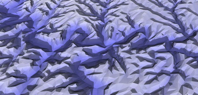
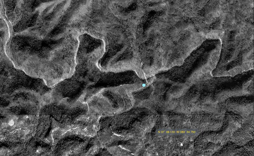
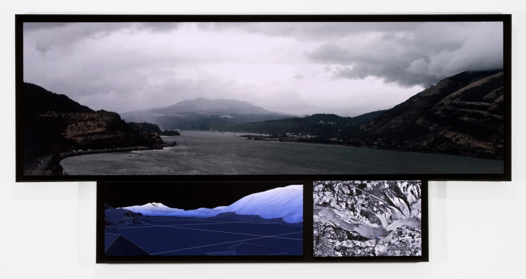
The exhibited pieces are triptychs that juxtapose three different ways of viewing these supposed sublime sites including panoramic photographic documentation, satellite aerial imagery of the location, and 3D computer graphic imagery of the topography using USGS topographical data as a source.

The work plays on our extraordinary ability to re-present nature while the qualities of sublimity remain elusive. The project reflects on parallels between technological and philosophical developments during the Enlightenment and those of our current ‘high-tech’ period, spawning some questions for thought: How does our ability to not only see land from satellites but also create digital reproductions of it affect our perception of the land? How does the process of locating a sublime site with technological aids, as opposed to serendipity, affect our experience of the sublime?

CGI created image of the site's topography.
Satellite view of site.
Satellite view of the site.
Photo: 'Favorite Bridge,' Daniel Boone National Forest, Kentucky, 36.841, -84.511
'Favorite Bridge,' Daniel Boone National Forest, Kentucky, 36.841, -84.511
Photo: Cadillac Mt., Maine, 44.211, -68.225
Cadillac Mt., Maine, 44.211, -68.225
Photo: Perfect View, Third Waterfall, Mississippi, N 31 04.382 W 091 31.466-Toolin-2005
'Third Waterfall,' Mississippi, N 31 04.382 W 091 31.466
Photo: Perfect View, Sugarloaf Mt., Maine, N 45˚ 02.084 W 070˚ 19.126-Toolin-2005
Sugarloaf Mt., Maine, N 45˚ 02.084 W 070˚ 19.126
Photo: Asgard, New York, N 44 25.528 W 073 40.109
Asgard, New York, N 44 25.528 W 073 40.109
Interview with Geocacher Fatboy Slim
Photo: Perfect View Route
Route taken - more than twelve thousand miles over two months. Sublime locations were recommended by geocachers nationally, and used as waypoints for route mapping.
Photo: Perfect View installation view
Photo: Vitrine containing the treausures attained at geocache sites.
Installation view, San Francisco Camerawork, 2005. Depicted are the expedition 'artifacts,'' including the vehicle used, the maps and GPS device, and 'treasures' (trinkets attained at geocache sites) exchanged at sublime locations.